![[DOOR FLIES OPEN]](https://doorfliesopen.com/wp-content/uploads/2015/08/DFO-MC-Patch.png)
Greetings fellow denizens of the internet. I am writing this from the glorious metropolis that is Millinocket, ME. I’m sure it was something before the timber companies all bailed out, but now it’s just a place to stay at a relatively cheap hotel before, and after, climbing Mt. Katahdin, Maine’s highest peak and an absolute bitch of a climb.
Katahdin is 5,269′ in height, which doesn’t sound like much, but it rises out of a pretty flat plain so of those 5,269′ you are going to go up, and unfortunately down, most of them. My son, who thinks Katahdin is the greatest mountain ever…
(he may not be wrong)
has climbed it 6 times. I have now climbed it twice. The first time I was 17. I am no longer 17.
Millinocket is 6+ hours from my house, so it’s a commitment to get up here and climb. I set out yesterday at about 1:00 pm, aiming for my 7:30 check-in.
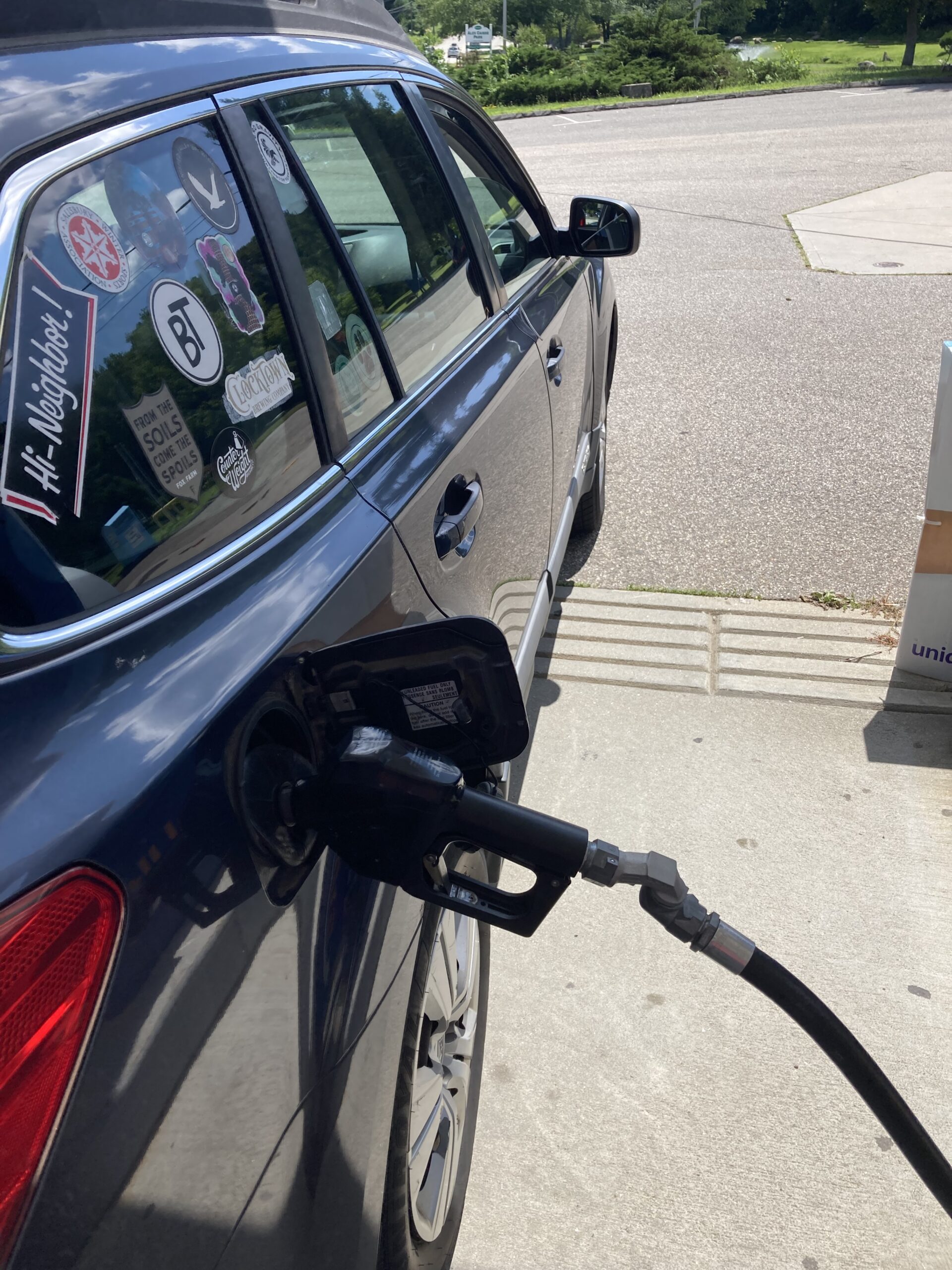
Here I am gassing up a 2010 Subaru Outback that has 246,000+ miles on it. Will it make it to Maine and back? As I write this I’m only halfway to yes, but it’s been a great car and last week I had them check all the belts, hoses, and fluids, then paid for a new serpentine belt, so it damn well better.
When I left the house to get gas the ETA per my GPS was 7:48. When I finished getting gas, going to the bank, then dropping the week’s bills at the post office I checked again.
8:18.
Uh-oh. Somewhere in the intervening 389 miles someone done fucked up. Nothing to be done, I must away, and away I go.
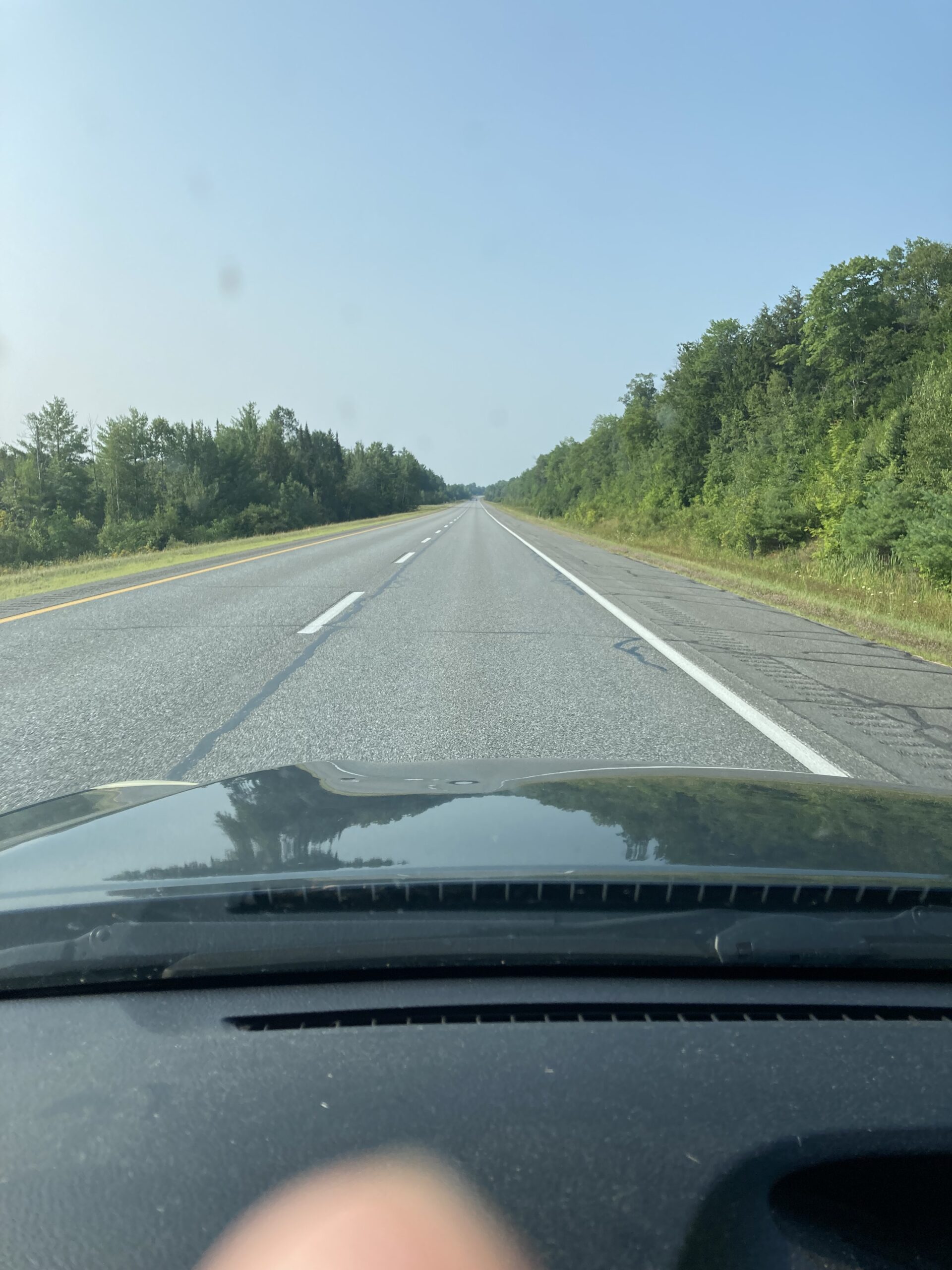
Relatively smooth sailing until I get to the changeover from I-290 to I-495. Fun fact that my kid didn’t tell me until later, this is apparently one of the biggest weekends for people to vacation in Maine! July 4th? Nope. Labor Day? Nope. The Friday I just wanted to get to Millinocket to hike with my oldest?

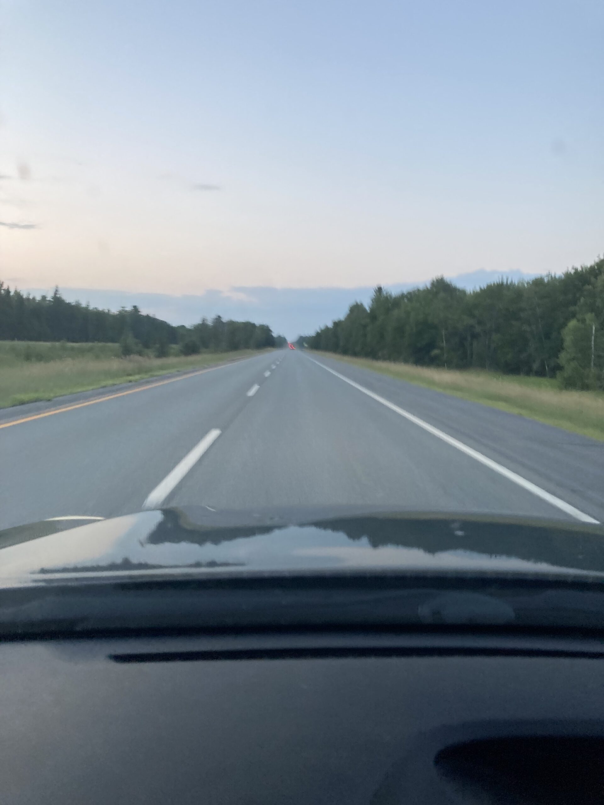
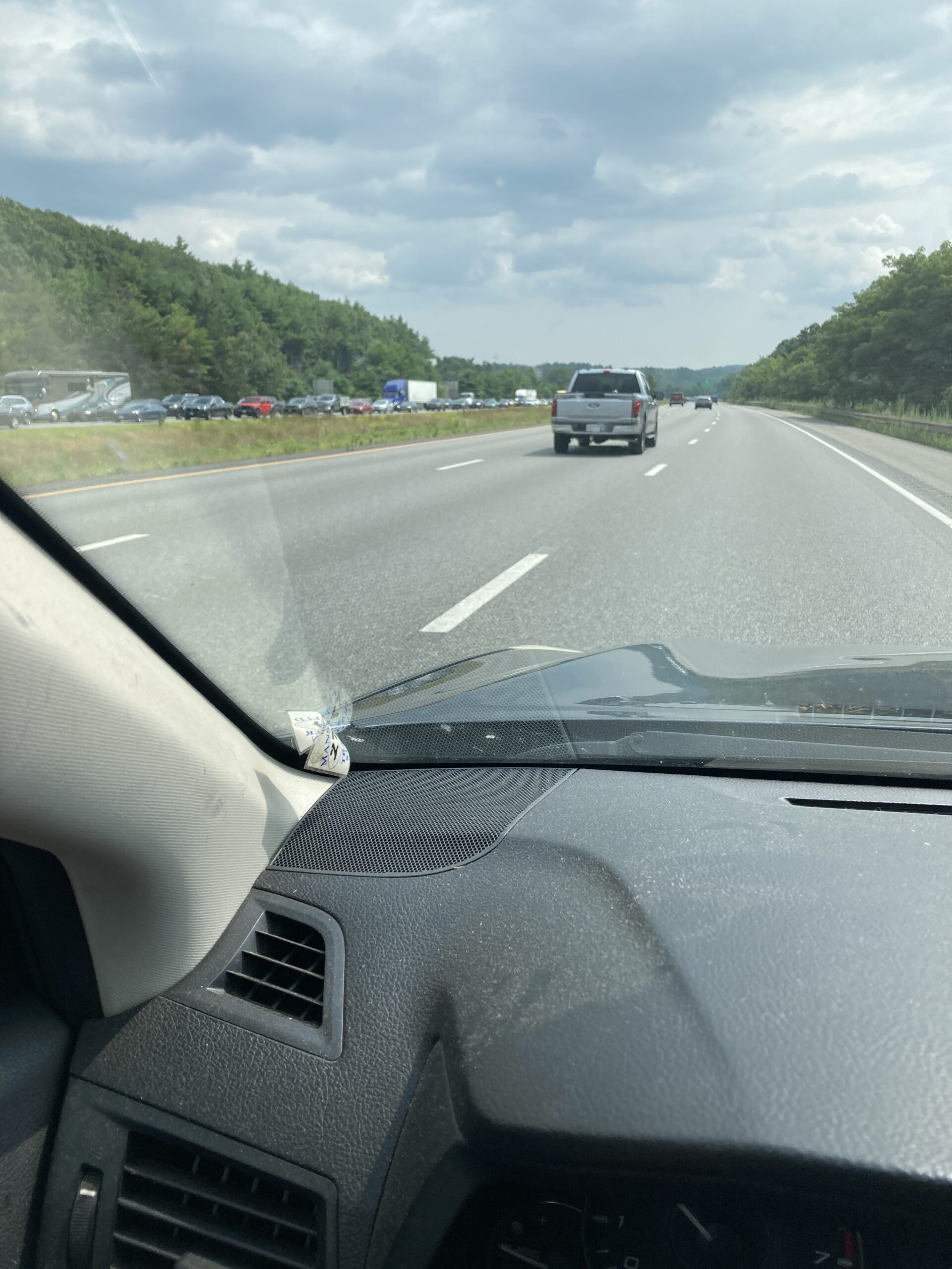
This is what the lane for 495 looked like on arrival.
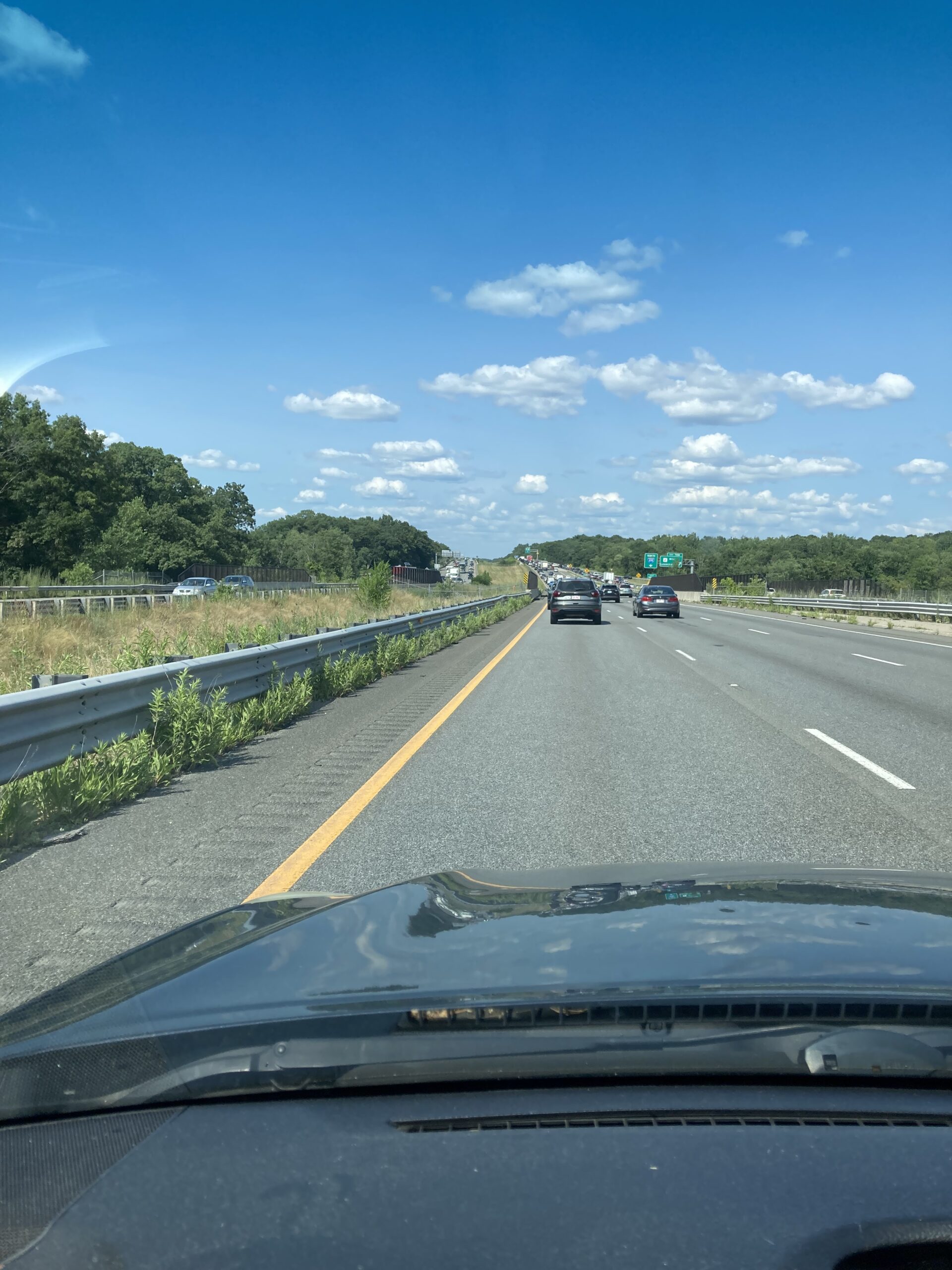
Traffic stayed like this, or worse, well into Maine. At one point I checked my mileage and determined I had traveled 115 miles in 3 hours. You can go ahead and do the calculations yourself, but that is neither highway speed nor likely to get you to Millinocket by 8:18.
Indeed, the very friendly voice on my phone, when not telling me about cars broken down on the side of the road or, (not that it mattered in these conditions), about speed traps up ahead, was telling me that traffic was getting worse, and that my arrival time was 8:20; 8:32, 8:48, and finally 9:01. I may have used a few bad words during this time.
Finally, I got through this traffic and into whatever-we’re-calling-Maine-above-Augusta. Traffic thinned considerably.
Until yesterday I had never seen Speed Limit 75 signs, but I have now. Seriously, it’s the Autobahn up there. Not a cop in sight and what are they going to do anyway when the speed limit’s 75? There are, however, a significant number of signs warning people about moose, and their inclination to wander across highways without so much as a ‘by your leave’ and people you do not want to hit a moose at 25, let along 75. Not good for the moose, not good for your car, and probably not good for you either. I made up some time in this area, but not too much, (again, older high-mileage cars and 110 mph do not mix) (I may have caught myself doing 90 at one point, but in my defense it’s like driving in a trance up here), and now my arrival was 8:54.
My son has been advised of my situation which he a) laughed at, and b) went ahead and ordered pizza and beer, after scouting out the Millinocket downtown and being a) offered a toke off a stranger’s joint then) being told everything closes at 9. He has the pizza ready when I arrive.
I will not tell you the name of the pizza place, nor did I take any pictures of it. You’re welcome. it was, beyond a shadow of a doubt, the worst pizza either of us has ever had. Needing to carbo load before the hike we each managed three pieces; the rest was donated to the trash.
Now, fun fact about Baxter State Park, unless you’re camping in the park you need to have a reservation to get in, you need to make that reservation months in advance, and you need to be at the parking lot when they open at 7:00, because at 7:05 they start giving spots away to people who show up the day of hoping to get lucky.
We pull into line at 7:01. We get to jump one line, because we have a reservation. As we pull up the rangers are closing the Roaring Brook lot, as it is full. “Where you going?” asks our ranger. My kid, because he’s my kid, says “Roaring Brook!” as cheerfully as you could possibly imagine. The ranger pauses, not sure whether to subtly wave us through, or tell us tough shit. “Nah, just kidding, we’re going to Abol.” The ranger, who clearly isn’t paid enough for this nonsense, asks us if we have any pets, firewoods, or drones with us. “No” we say, although my son does indeed have a drone with him. We did not use it, however. Hard not to have that noticed, and neither of us feels like getting arrested.
Oddly, no questions about guns.
Finally, it’s go time!
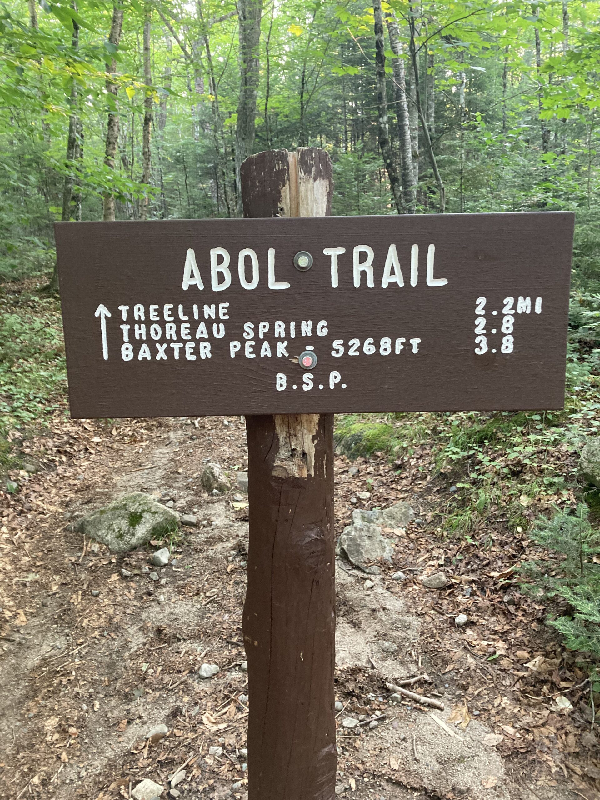
What a cute little sign, right? Nothing to worry about here! Just a quick hike of less than 8 miles and then we’re back, drinking beer and eating burgers!
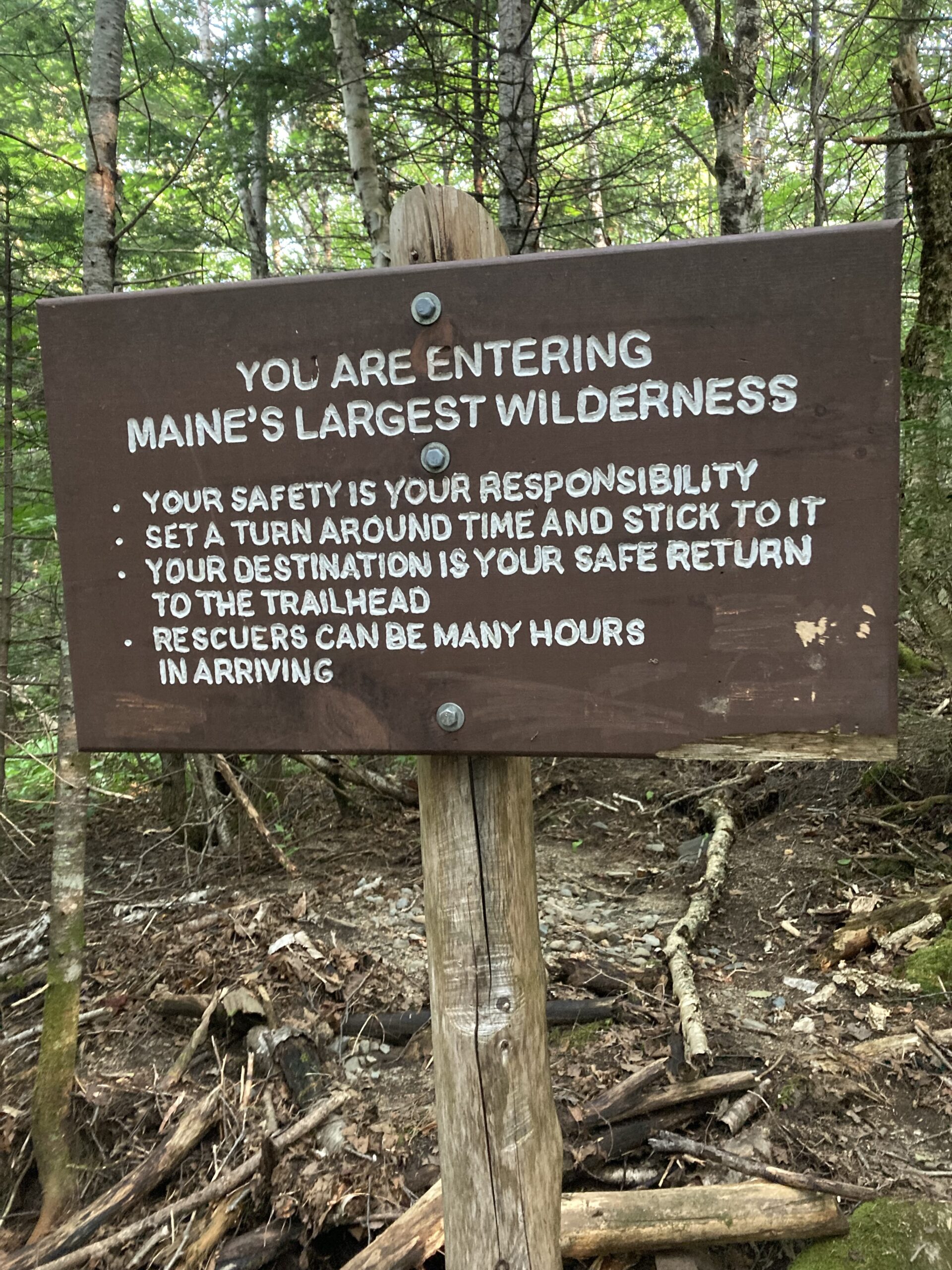
Oh. Oh that’s a bit different, inn’t?
Not to be deterred by such signs, or common sense, or age, up we go.
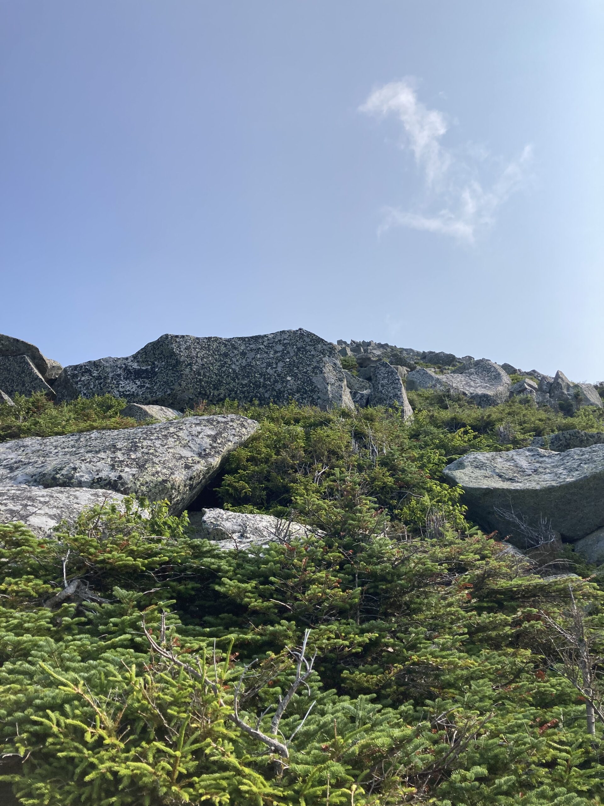
The first section is easy. Nice steady uphill over smooth ground. Nothing to this. Then there’s a section of very rocky trail, steep enough to require steps made out of rocks as well as switchbacks. I did get a good photo of us in this section looking up at where we need to end up, but there’s another hiker in it and I don’t know how to scribble his face out. C’est l’vie. Suffice it to say, steep, but nothing too bad.
Then we hit a mile of boulder scrambling. This sort of gives you an idea of what we’re dealing with here, although I took it on the way down rather than on the way up.
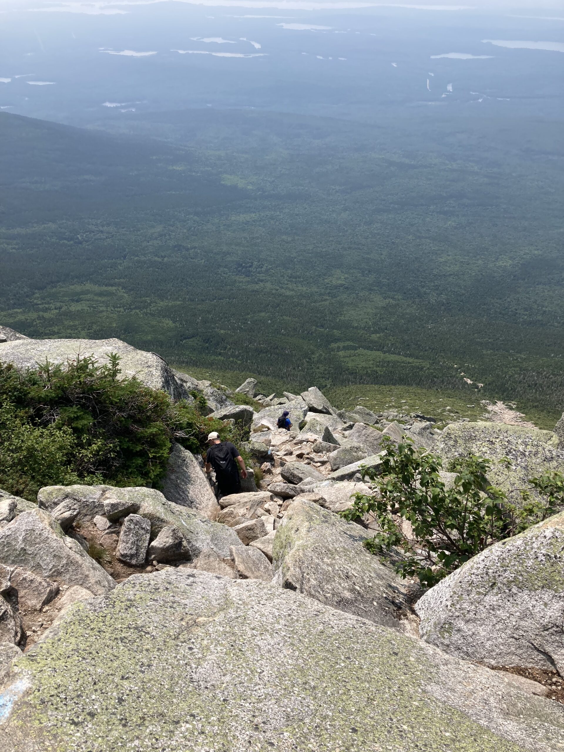
That gives you a good idea of the steepness, although not a great idea of what it was like scrambling up and down boulders. Mostly because I am not taking pictures while trying not to fall off boulders and rolling down that hill.
Here is a shot I took looking up at where we needed to go.
Mind you, that’s not the top of the mountain, that’s just the end of the boulder scramble. Not a real confidence builder looking up at that and thinking that, no matter how long you think that distance is, or how much time it’s going to take to cover, or how much it’s going to hurt, you’re underestimating all of it.
Nevertheless, we persisted, eventually coming out of the boulder scramble and reach the plateau that leads to the summit. This involves a long dull slog over broken ground, with the wind whipping at you while you try not to turn an ankle because you got excited that finally there was some flat ground and you don’t need to use your hands and then you didn’t see that small rock right in front of you. Also the view doesn’t really change from what you see here, at least not until you get up on the ridge.
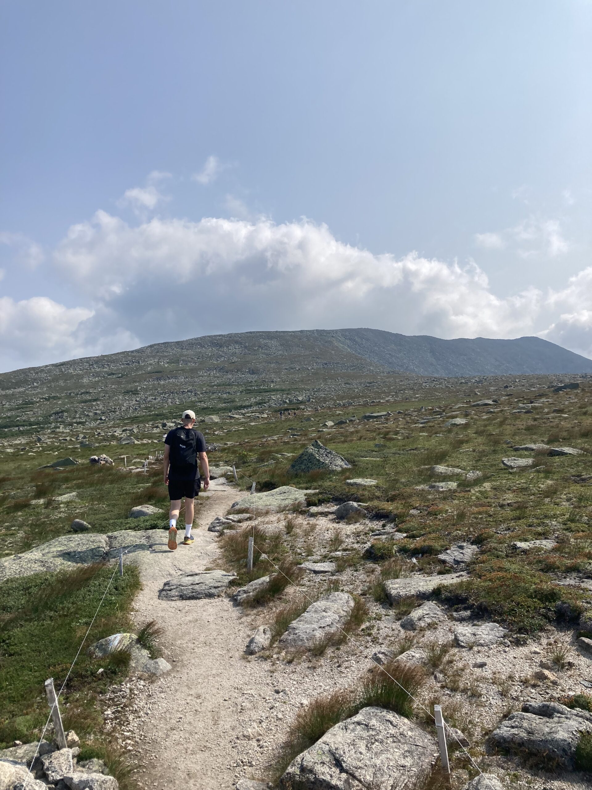
I may be related to the individual shown here.
The summit, Baxter Peak, is actually just off to the right of my son’s shoulder, sort of in the middle of the horizon, or pretty much on the left of the actual top ridge line. What looks like the summit, off to the right, is actually the incredibly originally named South Peak, which in reality is a few feet shorter than Baxter Peak.
It’s an illusion!

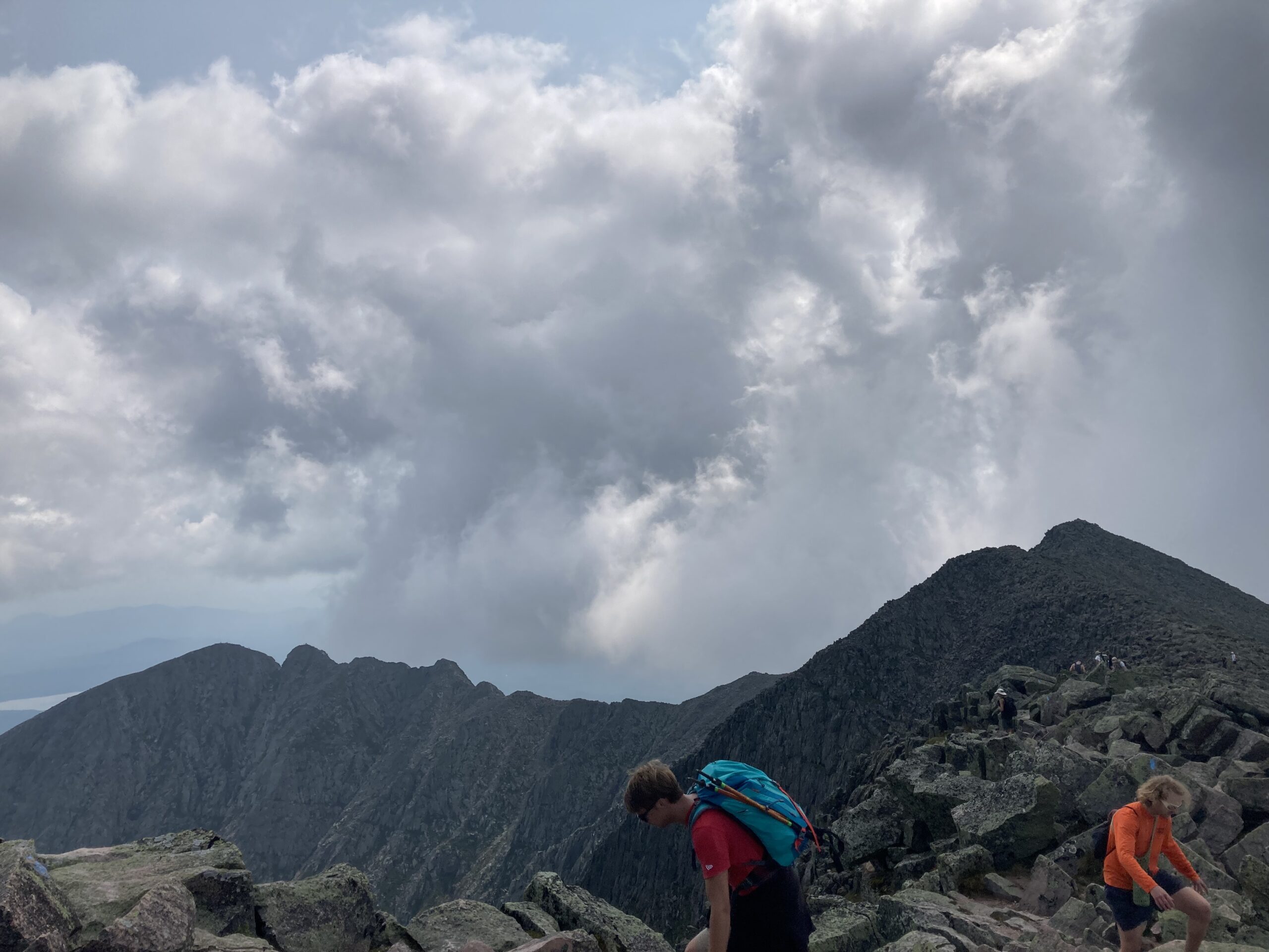
Here’s a view of the way over to South Peak. If you keep going you’ll be on what’s called The Knife Edge, which will take you over a peak called Pamola and, eventually, down into the Chimney Pond campground.
Here’s a picture of The Knife Edge trail, from the part where it gets its name.
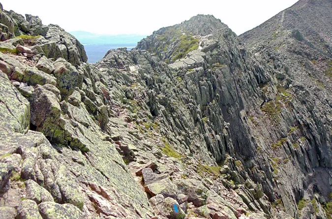
See that blue blaze at the bottom center? That’s the trail. This is pretty much the exact spot I tried to climb down to, from that pile of rocks to the left, because I had missed the blazes, (coming from the other way), and nearly gave my father a heart attack.
In my defense, who the fuck puts a trail there?
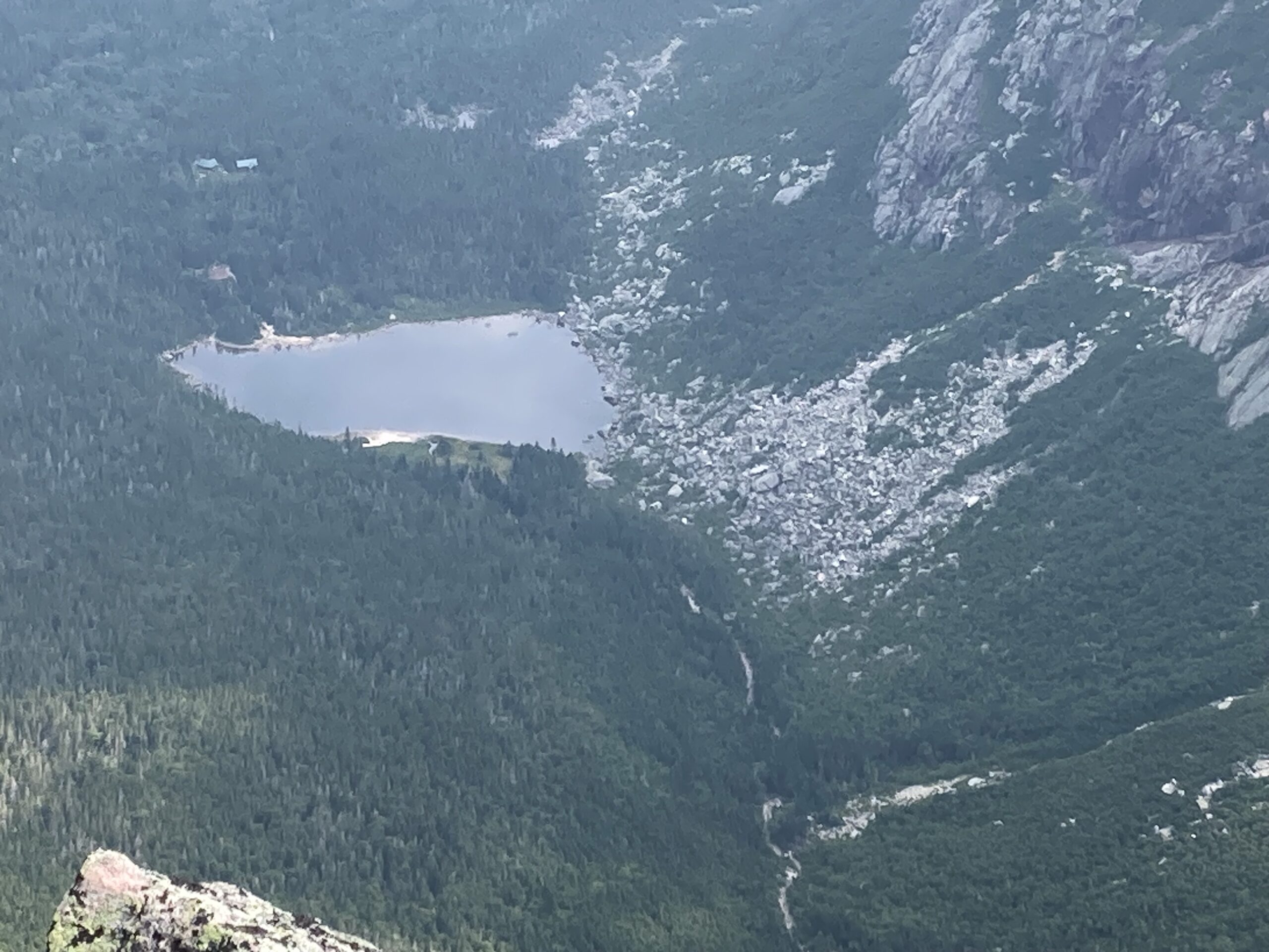
That’s Chimney Pond. The cliff to the right is the one you’ll be bouncing off of, (we estimated 800′ to the first bounce, back when I was scaring my father), if you fuck up on The Knife Edge. My son and I have both hiked it, but didn’t repeat it today, as it would have taken us way out of our way back to the car.
We did get to the summit.
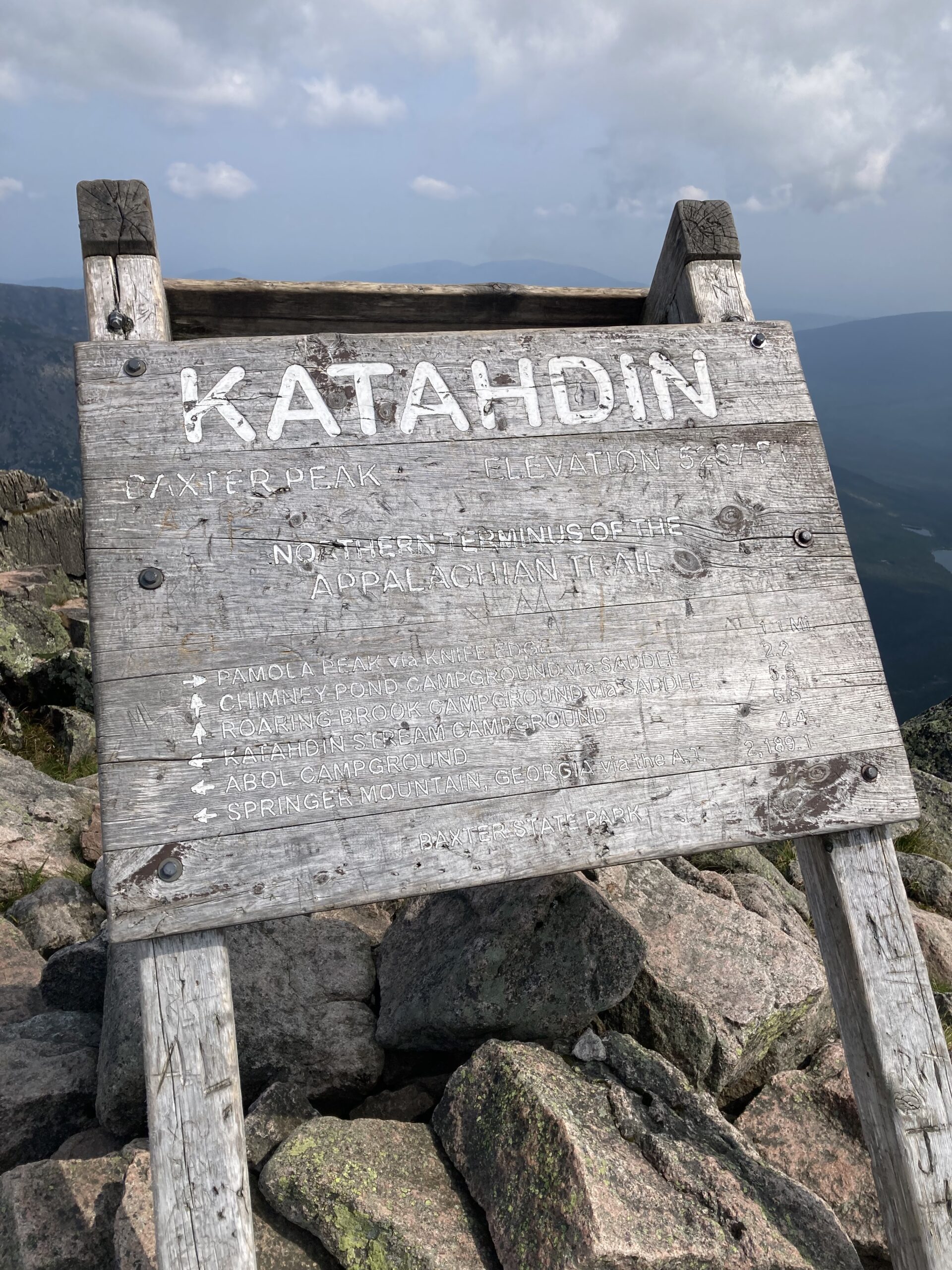
There’s a sign and everything. We do have shots of both of us by the sign, but pretty sure my son would like to avoid having his face here, so you’ll have to take my word for it.
Anyway, long story longer we then had to turn around and do the same thing in reverse.
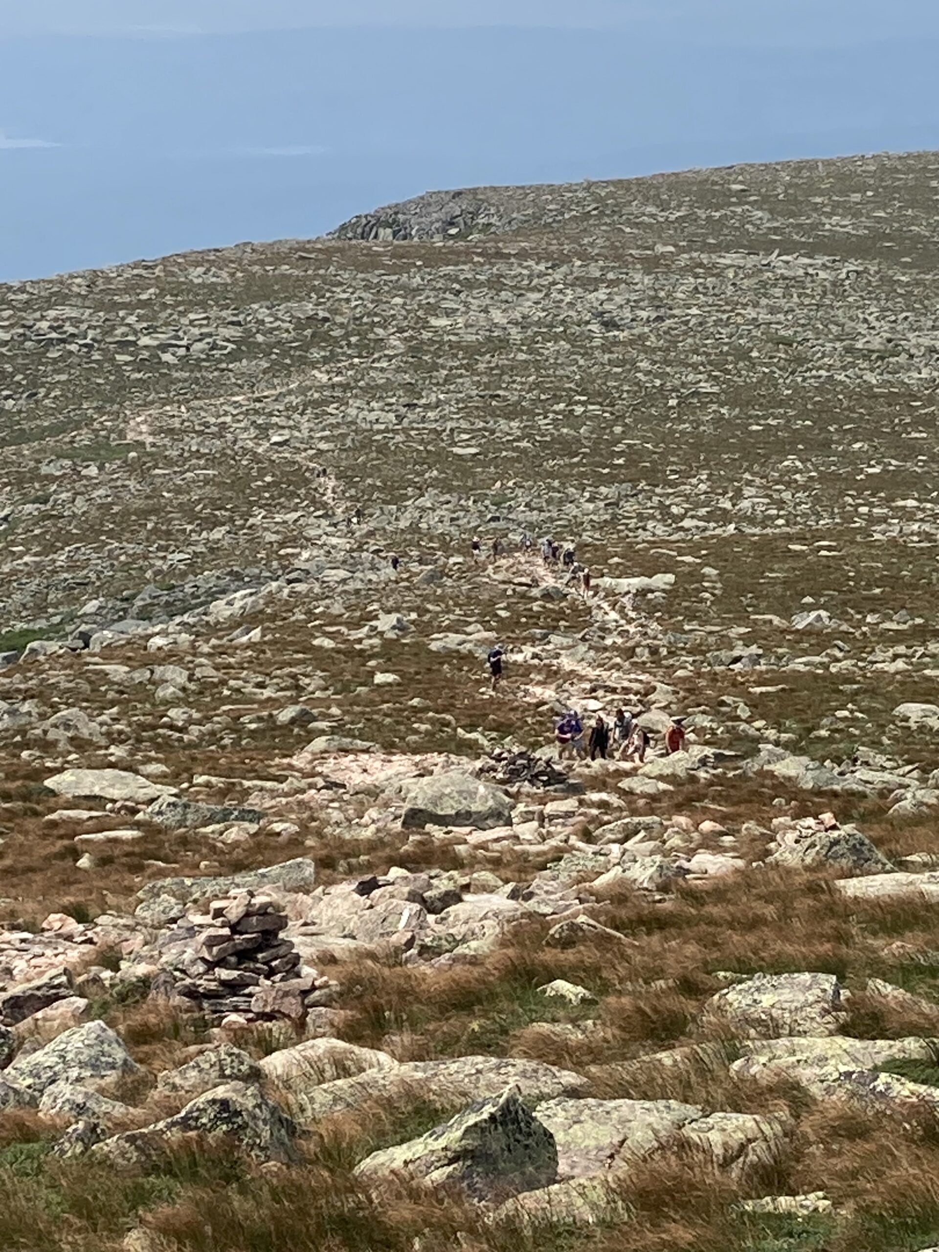
These are the crowds coming up out of Abol towards us as we came down off the peak. Looks like Everest on a sort of slow day.
The trip down sucked. I’m too old to hammer my knees, (and I even wore braces), on rocks while dropping 3300′ of elevation over 3.8 miles. Pretty sure my days of hiking trails like this are in my past, so I’m glad the potentially last one was with my son, and also glad that I was able to pass my love of hiking and climbing on to him. Hope he gets his knees from someone else.
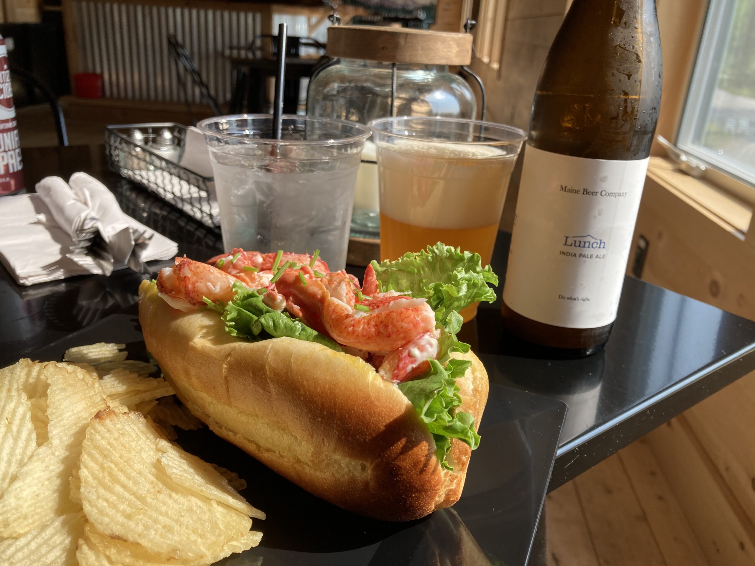
To the victors go the spoils.
The rest of you are…well, not on the clock, but go ahead and talk amongst yourselves.
*Author’s note: My awesome old car got me safely back. Some traffic, but nothing like what I had to deal with on the way up. It was pretty awesome being able to set the cruise control at 74, in a 75 mph zone, and just go for the first 140 miles.
Not a lot going on in north-central Maine at 8:00 am on a Sunday. I did see two ravens while going back to the place that served me the lobster roll up there, (I’ll give them a plug: Golden Road Crossing), on the theory that they might make a halfway decent breakfast as well.
Two words: Breakfast Stromboli.

My life has been changed forever. That’s not theirs. Theirs was better, but I ate it too fast to get a picture.
This is the traffic jam I saw on the other side of the highway as I neared the end of my journey, (having stopped off for BBQ), and I am eternally grateful that didn’t happen Friday, because I don’t think I would have made Maine. It extended for miles. Still trying to find out what happened, but it’s the kind of jam you see when they park two fire trucks across all three lanes of traffic so they can land a helicopter-ambulance. Drive safe out there, people.


Leave a Reply
You must be logged in to post a comment.